A work colleague was telling me last Thursday about his family's struggle to get hold of the details of a planning application for a new-build school on a field at the bottom of their garden. When they finally managed to get hold of the plans – any scale or measurements that would tell them how close to their garden, or how high, the new building was to be were absent.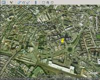 That can make it rather tricky to make an informed decision on responding to a planning application.
So we started talking about the potential presented by tools like Google Earth for genuine 3D planning applications that could let you see exactly how a building might affect you. Or that would let citizens engage in informed dialogue with architects and planners on the creation of democratised, accessible and creative public spaces and building projects.
The possibilities are exciting. The reality, in the UK at least, may lag behind.
The licence fees demanded by Ordinance Survey for UK mapping data continue to stiffle geo-related innovation, and even finding out about the planning applications near you can be a challenge, let alone being able to effectively visualise what the applications amount to.
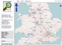 So whilst we've got access to a growing number of free-to-use tools for online mapping (not least google maps and earth), and while efforts to create wholly free mapping data like the amazing OpenStreetMap are groundbreaking, we're still short on the depth of data and the open access that we need to really innovate and make a difference with our geodata.